Land, livelihoods and climate: researching the nexus of change in the Kavango-Zambezi Transfrontier Conservation Area of Southern Africa
National Science Foundation-funded project (#1560700)
National Science Foundation-funded project (#1560700)
KAZAVA Executive Summary - Zambia. February 2019. pdf
|
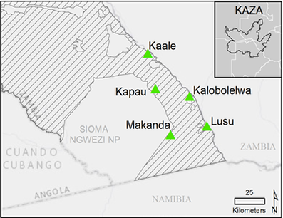
The Zambia Executive report represents a summary of initial findings from a region in the Lower West Zambezi Game Management Area within the five village areas highlighted in green . Household surveys were done in July 2018 and were designed to measure household livelihoods and vulnerability. Questions focused on farming, adaptation to drought and flooding, interactions with wildlife, sources of income, and resource collection. The same survey was administered in Botswana and Namibia villages in 2017. Additionally, natural resource use areas were mapped to provide a more nuanced understanding of how people make use of their surrounding environment by mapping the places where people go to collect resources and reference samples collected to validate 2018 conditions on the ground for satellite-based remote sensing analyses.
|
Descriptions represent 2-page summaries of different components of the KAZAVA project. These short summaries were shared with various stakeholders and organizations in the KAZA region. Additional details and updates to various methods can be found in the Publications tab.
|
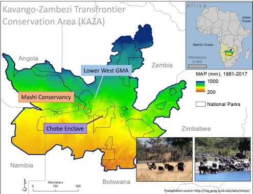
KAZAVA has three study areas spread across a gradient of mean annual precipitation (MAP), LWZ-GMA, Zambia, Mashi Conservancy, Namibia, and the Chobe Enclave communities, Botswana. A total of 726 household surveys were completed in June and July, 2017-2018, and supplemented with remotely sensed data and resource use area mapping.
One of the key features of the project is a primary focus on “operationalizing” a study of household vulnerability with respect to food security. As researchers we have identified key physical gradients that affect growing seasons, such as mean annual precipitation and average rainy season lengths. However, vegetation conditions, household members and their education, access to natural resources, and more all interact to affect households and their access to food. The Conceptual Framework description explains how we aim to operationalize vulnerability. Find more detail here. |
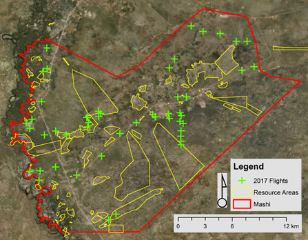
Unmanned aerial system flights and resource use areas in Mashi Conservancy, Namibia (2017).
|
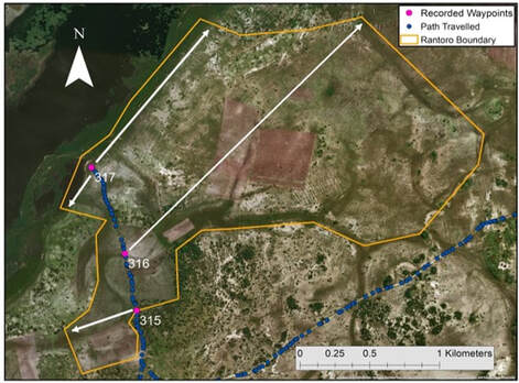
Sample resource area digitization of the Rontoro area in Botswana. Waypoints were collected at three points and the area’s boundary was reconstructed from field notes.
|
